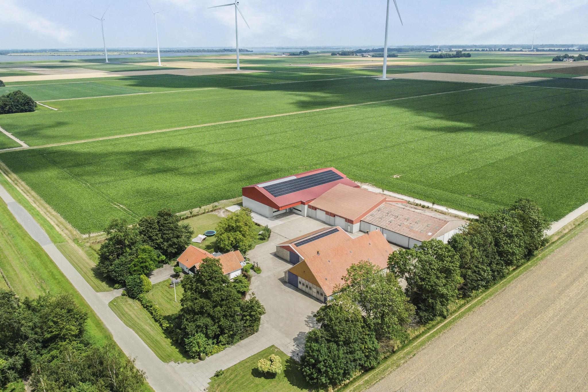
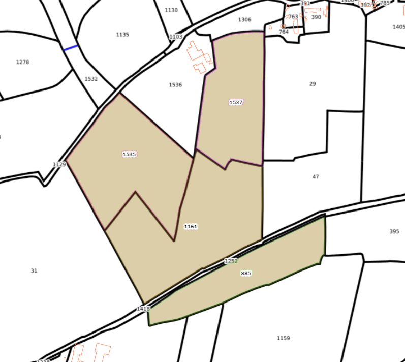
Plots of agricultural land located on and near Hovensreed in Dongjum.
Friesland , Netherlands
Characteristics
Characteristics
Description
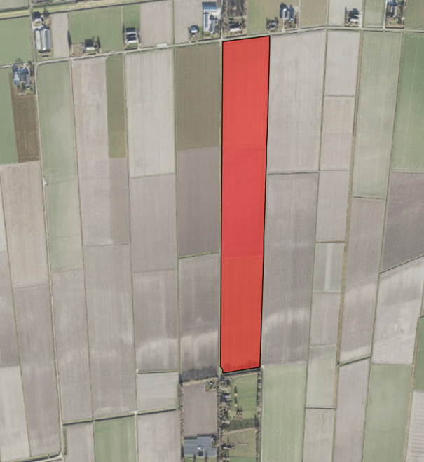
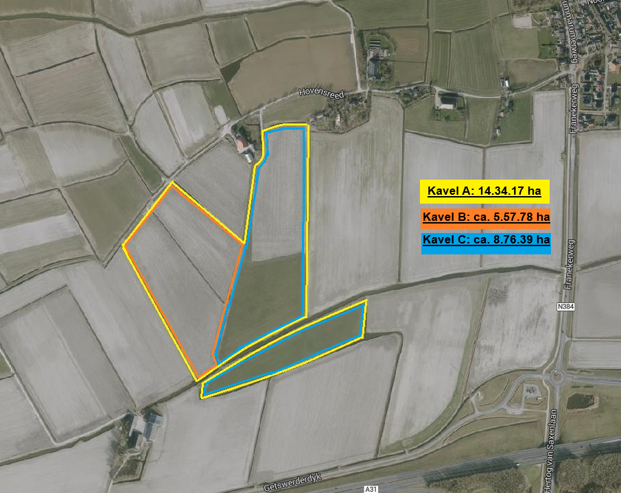
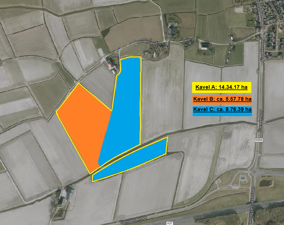
Plots of agricultural land located on and near Hovensreed in Dongjum, total 14.34.17 ha,
divided into 3 plots:
Plot A (= plot B + C): 14.34.17 ha
Plot B: approx. 5.57.78 ha
Plot C: approx. 8.76.39 ha
The bidding form including accompanying conditions can be requested via info@agrivastgoed.nl.
The bidding form must be submitted no later than March 3, 2026 at 12:00 PM.
Information: Mr. Eelke Turkstra 06-51260942.
Soil type
The soil type is partly heavy loam clay and a small part light loam clay.
See the brochure for more information.
Crop rotation
Boer & Bunder provides the following titles indicating how the arable land has been used over the past 5 years:
- Temporary grassland;
- Silage maize;
- Seed potatoes NAK;
- Permanent grassland (the left part of parcel number 885).
See the brochure for more information.
Parceling
Plot A (the whole) consists of 4 parcels. Plots B and C each consist of 2 parcels.
Drainage
The entire plot is drained.
Access
Plot B is accessed via an easement through parcel number 1129 (path) and plot C is accessed via the adjacent parcel number 1306, via a hardened path (Stelcon plates). The two parcels of plot C are connected by a dam over the water board ditch.
Spatial plan
The spatial plan is described in the brochure.
Hunting rights
The hunting rights are leased.
Easement
Parcel numbers 885, 1161, 1535, and 1537 have right of way to and from the public road (Hovensreed), over parcel number 1129 in the current manner and via parcel 1306 over the installed Stelcon plates.
Real right
Parcel number 1161 has a real right annotation for the benefit of Gasunie Transport Services B.V. (gas pipeline).
Qualitative obligation
There is a qualitative obligation for the benefit of Wetterskip Fryslân regarding parcel number 885. This means Wetterskip Fryslân uses the land as an overflow area due to excessive rainwater, as often as Wetterskip Fryslân deems necessary, useful, or desirable.
Chain clause
For the parcels, exemption from transfer tax has been granted, as referred to in article 15 paragraph 1 letter q of the Dutch Transfer Tax Act, which the seller invoked on 01-03-2024. Based on the above, the buyer indemnifies the seller against any (additional) transfer tax assessment if the buyer does not exploit or have exploited the sold property as referred to in the aforementioned article 15 paragraph 1 letter q within 10 years after 01-03-2024.
Survey of parcel number 1161
If the sale takes place in the form of plot B and plot C (thus 2 different buyers), a survey of parcel number 1161 will be conducted. The survey will take place before the legal transfer date. The costs of this survey will be borne by the seller.
When splitting the plot into plot B and C, the easement for access to plot B is only via path 1129 and access to plot C only via parcel 1306 with the Stelcon plates. These easements will therefore remain. The mutual easements between plots B and C will be cancelled and buyers will cooperate to record this in the deed.
Use of parcel
Parcel number 1537 and part of 1161 (approx. 6 ha), which actually form one parcel, have been leased this year for potato cultivation. Actual delivery of this part will take place as of November 1, 2026, subject to further consultation.
OTHER
Delivery: The lands will be delivered free of harvest.
Acceptance: As of the date of deed signing at the notary.
Date of deed signing: No later than May 1, 2026. Due to leasing part of plot C, the date of deed signing for this parcel is subject to further consultation.
Payment: On the date of deed signing.
Settlement of charges: On the date of deed signing.
Costs: The costs related to the purchase are fully borne by the buyer. These include, among others: notary fees, land registry fees, and any transfer tax payable.
Viewing: At your own convenience.
Information
Mr. Eelke Turkstra
Agri Vastgoed B.V.
06 - 51260942
The brochure can be requested via 058-2849171 or via info@agrivastgoed.nl.
We advise you, as a prospective buyer, to study the zoning plan.
For the full description and the (other) applicable zoning plans, you can consult www.omgevingswet.overheid.nl.
For further information about the Spatial Plan, you can request information from the municipality of Waadhoeke, Harlingerweg 18 (8801 PA) Franeker, tel: 0517-380 380 and www.waadhoeke.nl and www.omgevingswet.overheid.nl.
Although the utmost care has been taken in preparing this information, no rights can be derived from it. Changes are always reserved by the seller.
.We strive to contact you within 48 hours.


The Netherlands
With a population of over 17 million and an area of 41,543 km², the Netherlands has a high population density of 504 per km². About 18% of its surface area consists of water, and a significant portion of the land and population is located below sea level. The country is protected from water through a system of dikes and waterworks. Polders have been created through land reclamation. The landscape of the Netherlands is flat almost everywhere. The Dutch landscape mainly consists of cultural landscapes and managed nature reserves. Over the centuries, not only has the natural environment changed, but due to the shrinking and fragmentation of habitats and environmental pollution, both the quality and quantity of nature have deteriorated. Efforts are being made through nature policy and private initiatives to reverse this trend.
Through diversification in agriculture, entrepreneurs must also try to generate income from non-agricultural activities. These include agricultural nature and water management, agro-tourism, and care farms.